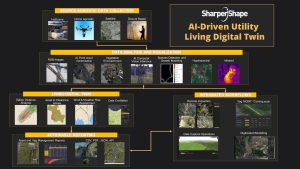
AI-Powered Solution for LiDAR Classification and processing
Smarter Classification, Faster Results, Lower Costs
LiDAR is incredible, delivering ultra-precise data with unmatched detail. But handling that data? It’s no small feat—it demands massive computing power and advanced engineering.
That’s where LiDAR Insights comes in. Our LiDAR Insights combines a state of the art AI point cloud classifier with 29 utility network focused classes. We harness the power of a sophisticated neural network to process your data seamlessly, helping you and your vendors reduce the time between Point Cloud collection and delivery.
Faster
Tired of waiting months to process your LiDAR data?
We are here to change the game! We can slash your processing time from months to just days—or a few weeks, depending on your data volume. Imagine having your data ready when you need it, not long after. Don’t let slow processing hold you back—let Sharper Shape accelerate your workflow and get you results faster than ever before!


High Accuracy
Our LiDAR Classification excels in dense distribution network areas.
State of the art, best in class ML point cloud classification with 95-98% accuracy plus an F1 score of up to .98*
Tested against manual classification vendors and alternative automatic approaches. LiDAR Insights comes out on top!
*data and class dependent, some classes may be merged
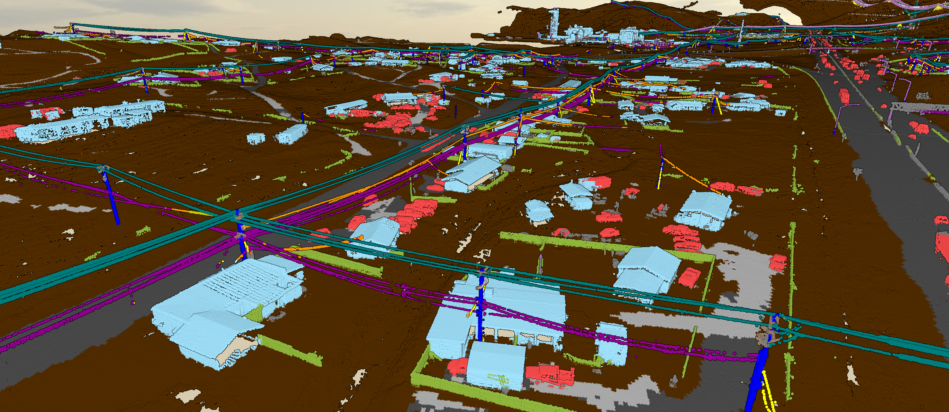
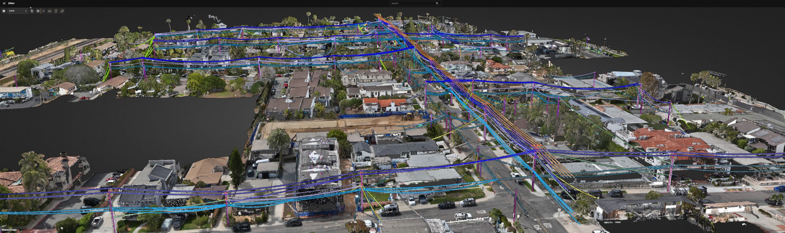
Smart Utility Classification
29 Electric Utility Classes
Our LiDAR Insights leaves the competition in the dust! We support an impressive 29 electric utility classes—that’s over 3 times more than our competitors. And when it comes to electric utilities, we’ve got you covered with 8 dedicated wire classes for unmatched precision and versatility. More classes, more power, more possibilities.
_copy_jpg")

Elevated outcomes, minimized cost
Cost-effective, AI-powered LiDAR Classification
By automating point classification with reliability and speed, we significantly lower costs and accelerate your path to deliverable-ready data.
Quick, affordable, and accurate LiDAR data.
The World Needs More 3D data – the World Needs An ECLAIR
ECLAIR (Extended Classification of LiDAR for AI Recognition is an open-source dataset, developed by Sharper Shape consisting of more than half a billion points captured by long-range high-accuracy LiDAR.
The dataset has then been augmented with point-wise semantic annotations. In short, ECLAIR is a high-fidelity, LiDAR-fueled data rich digital twin of the powerline network.
LiDAR classification by the numbers
~1.63 million
Acres of European land destroyed by wildfires in 2020
240,000
miles
US HV transmission lines
Plus, millions of miles of distribution lines across the country
40
years
Average age of infrastructure
And more than 25% of US transmission infrastructure is 50 years old or older
~7.2 million
Acres of land in the US were ravaged by wildfires in 2020
featured solutions