
Chris Beaufait, CEO, Sharper Shape | August 24, 2026
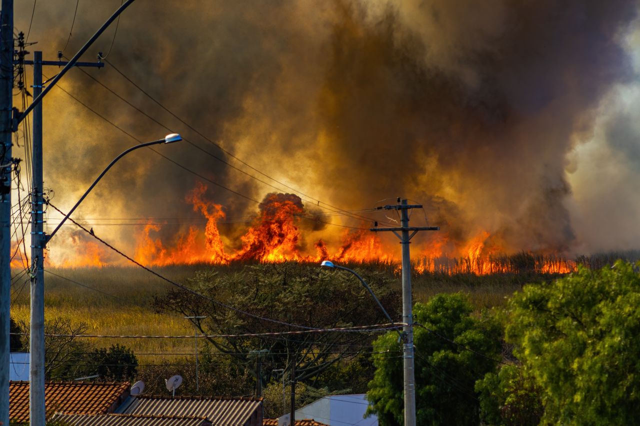
Three weeks after the Spokane Area Fires started, the evacuation orders are lifted and the fire lines are quiet. What is left is the accounting. The Old Trails, Autumn Lane and Fairview fires burned roughly 10,000 acres across Spokane County in a matter of days, damaged or destroyed more than 900 structures and pushed an estimated 65,000 people out of their homes with almost no warning. More than 1,700 firefighters worked the complex. Suppression alone ran into the tens of millions of dollars. Thousands of people are now sorting through what is left of a house or figuring out where they live next.
We also know how it started. Investigators determined the Old Trails Fire was set deliberately, and a 37 year old man has been charged with multiple counts of first degree arson. According to court records he planned it roughly two weeks out and used weather apps to pick the day conditions would be at their worst.
That detail matters, and not in the way people might expect a grid company to say it does. The ignition source here was not a utility asset. But an arsonist choosing his date off a forecast is a blunt reminder that ignition is the one variable none of us controls. What we can influence is everything downstream of it: how much fuel is standing against the line when the wind comes up, what the grid does while a fire is moving and how fast a community gets its power and its footing back afterward.
My first thought, three weeks on, is still for the families who lost homes and for the crews who held those lines under red flag conditions for days. That comes before anything else.
But I would be doing my job poorly if I did not also say what this fire confirms for those of us who work in grid infrastructure. The systems we build have to keep pace with a climate that no longer behaves the way our maintenance cycles assume it does.
For most of the last century, utilities inspected their networks on a schedule. Climb the pole, walk the line, fly the corridor, file the report and move on. That cadence made sense when wildfire season was a season and vegetation grew at a predictable rate. It does not make sense now. Fire risk in the West is no longer seasonal. It shifts week to week with wind, moisture and fuel load, and a three year old inspection report cannot tell a utility whether a specific span of conductor is clear of vegetation today. It is not only a West Coast story either. Heat, wind and drought are showing up across the country, and fire is reaching utilities that never used to plan for it.
That is the gap a living digital twin of the grid is built to close.
A static inspection is a photograph. A living digital twin is closer to a heartbeat. It is a geospatially precise model of every pole, conductor, span and tree along the network, refreshed with each new capture rather than every few years. At Sharper Shape, our CORE platform holds that model. It tracks how each asset and the vegetation around it changes, flags what has moved since the last look and lets planners query the network based on the latest available information and using information captured over time. And because what CORE keeps is a model and not a stack of finished reports, the same data can be run again when clearance standards or risk thresholds change.
Digital intelligence is a wildfire strategy, not a data project. For a utility operating in a high fire threat district, that shift changes what is possible in a few concrete ways.
It means vegetation risk stops being an annual clearance sweep and becomes a live map. Which spans are closing on minimum clearance. Which trees are growing fast enough to be next season’s problem. Where the density of risk sits on top of the density of homes. Crews and budgets go to the corridors that matter most instead of the ones that happen to be next on a fixed rotation.
It means public safety power shutoffs can get more surgical. When an operator can see, span by span, which parts of the network actually carry elevated risk under today’s wind and fuel conditions, the call can be a few miles instead of a whole region. That difference lands on the hospitals, water systems and families who lose power every time a shutoff is made out of caution rather than knowledge.
And it means restoration is safer. Crews returning to re-energize a damaged network need to know what changed. Which poles leaned, which spans dropped, which structures are no longer where they were. A network that has been tracked all along and which can be searched by asset and over time, gives them that answer in minutes instead of days spent piecing it together by hand.
None of this replaces firefighters, meteorologists or the hard physical work of vegetation management crews. It is not a claim that any one piece of software prevents a wildfire. It is a claim that utilities making decisions about risk deserve the best and most current information the organization has, available to everyone who needs it.
We know now that a person started this one on purpose. That in itself is hard to sit with, and it is a matter for the courts. But nobody set the wind, the heat or the years of fuel buildup that turned one ignition into 10,000 acres and 900 lost structures in a few days. Those conditions will be waiting for the next spark, wherever it comes from. Grid intelligence has become core infrastructure, not nice to have.
We built Sharper Shape because a utility deserves access to the most current possible grid intelligence. Spokane is a hard reminder of why that work matters, and of how much of it is left to do.