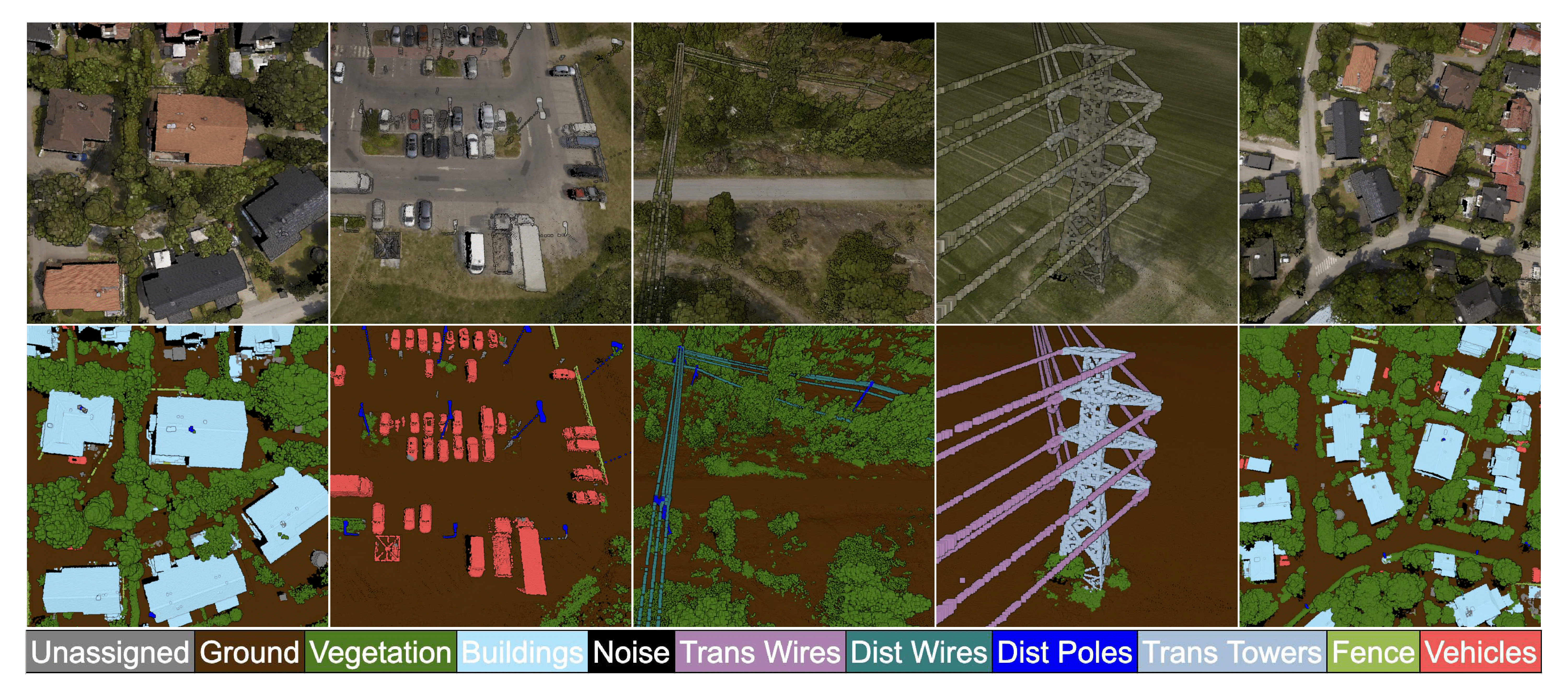
In this paper, Sharper Shape introduces ECLAIR (Extended Classification of Lidar for AI Recognition), a new outdoor large-scale aerial LiDAR dataset designed specifically for advancing research in point cloud semantic segmentation. The dataset is engineered to move forward the fields of 3D urban modeling, scene understanding, and utility infrastructure management by presenting new challenges and potential applications.
We have released the dataset as open-source and it can be accessed through a link found in the paper. Please fill out the form below for a copy of the research paper.