At Sharper Shape, we live and breathe data. It’s at the very CORE of what we do, and how we support our customers. For more than a decade we have empowered tier one utilities with a laser focused look at their infrastructure, underpinned by technology and data collection.
So, it’s only right then, that in tandem, we’re looking at the next big thing in artificial intelligence (AI) and machine learning.
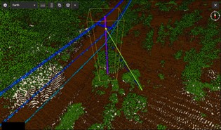
For us that’s ECLAIR (Extended Classification of LiDAR for AI Recognition). ECLAIR is an open-source dataset, developed by Sharper Shape, covering a contiguous area of more than 10km2 of Espoo, Finland home to one of our technology centers, consisting of more than half a billion points captured by long-range high-accuracy LiDAR.
Captured aerially by helicopter using Sharper Shape’s Heliscope, data capture focused on electrical transmission lines, which consequently shape the point cloud network. The dataset has then been augmented with point-wise semantic annotations. In short, ECLAIR is a high-fidelity, LiDAR-fueled data rich digital twin of the powerline network in the target area.
Understanding LiDAR and its applications
LiDAR, which stands for Light Detection and Ranging, is a remote sensing technology that uses laser light to measure distances and create detailed three-dimensional maps. In the case of ECLAIR, this map covers an entire city, but for utilities, the output can look like 100s of miles of power cables and all their surrounding environments.
It’s a powerful tool when used as part of a utility’s arsenal, allowing them to stay proactive instead of reactive when it comes to operations and maintenance.
Our Sharper CORE platform is enriched with state-of-the-art LiDAR data, allowing you to fully scrutinize every bolt of every asset. By utilizing AI algorithms, we’re able to predict and prevent failures with a fully prioritized asset management plan.
It all comes together in Sharper CORE
Sharper CORE allows you to:
- Proactively manage powerlines and the areas around them by monitoring nearby vegetation and structural weaknesses
- Prepare for extreme weather events like wildfires or flooding with an informed plan and strategy
- Maintain steady electricity supply to your customers, or let them know in advance of an outage
Explore predictive asset management
What’s next for LiDAR?
AI and machine learning tools are developing all the time, with platforms like ChatGPT already becoming household names. But what future impact could they have on our infrastructure and public services?
Outdoor 3D scene understanding is essential for many applications in computer vision, from autonomous driving, to robotics, to augmented and virtual reality. At Sharper Shape, we use such data to drive advances in powerline inspection and utility management. A step further into the future, authorities will be able to use such datasets to understand and develop critical infrastructure resilience to natural disasters such as floods and wildfires, and to bolster conservation efforts with a more granular understanding of vegetation and urban green spaces.
All these use cases depend on the development of AI tools that can accurately generalize to real-world scenarios. This in turn depends on the availability of large, rich datasets, like ECLAIR, that can be used to experiment with and train innovative deep learning models.
Step into the future – get in touch with us!
The ECLAIR dataset can be found on GitHub. More information can be found in our paper: ECLAIR: A High-Fidelity Aerial LiDAR Dataset for Semantic Segmentation on the Sharper Shape.